
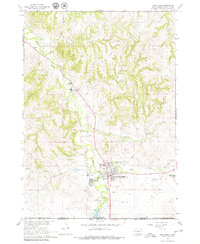
1967 Map of Pine Ridge
USGS Topo · Published 1969About this map
Pine Ridge serves as the focal point of this landscape, situated along the White Clay Creek just north of the South Dakota-Nebraska state line. The town's layout reflects a communal hub within the Pine Ridge Indian Reservation, featuring essential local institutions like the Oglala Sch, Holy Cross Cem, and the Oglala-Sioux Sundance Arena. The presence of the Holy Rosary Sch and various mission-related sites highlights the area's social history during the late 1960s.
Find a feature on this map
25 named features on this map. Tap any name to fly to it.
Don’t see what you’re looking for? This feature index may not catch every label — zoom into the map to look around manually.
Map Details
Editions of this 1967 Pine Ridge Map
2 editions found
Other maps of this area

1955 · Hot Springs
USGS Topo · 1:250,000

1955 · Alliance
USGS Topo · 1:250,000

1957 · Alliance
USGS Topo · 1:250,000

1958 · Alliance
USGS Topo · 1:250,000

1967 · Pine Ridge SW
USGS Topo · 1:24,000

1967 · Pine Ridge NE
USGS Topo · 1:24,000

1967 · Manderson
USGS Topo · 1:24,000

1967 · Oglala
USGS Topo · 1:24,000

1967 · Manderson SW
USGS Topo · 1:24,000

1969 · Whiteclay
USGS Topo · 1:24,000