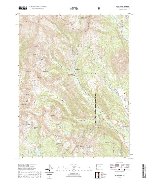
2022 Map of Oh-be-joyful
USGS Topo · Published 2022About this map
White River National Forest and Gunnison National Forest meet in this high-altitude landscape, where the Ruby Range and Scarp Ridge define a complex geography of alpine basins and glaciated peaks. The drainage of Slate River and Oh-be-joyful Cr provides the primary orientation for a network of historic trails and mining-era footprints. Modern recreation is mapped alongside remnants of industrial history at Elkton, Pittsburg, and Irwin, indicating the shift from 19th-century resource extraction to a wilderness-focused economy. Dozens of named basins, such as Democrat Basin and Dippold Basin, sit below peaks like Schuylkill Mtn and Oh-be-joyful Peak. The intricate trail system, including Daisy Pass Trl and the Washington Gulch Snowmo/Ski Trl, illustrates how these former mineral routes have evolved into conduits for backcountry exploration.
Find a feature on this map
86 named features on this map. Tap any name to fly to it.
Don’t see what you’re looking for? This feature index may not catch every label — zoom into the map to look around manually.
Map Details
Editions of this 2022 Oh-be-joyful Map
This is the sole edition of this map. No revisions or reprints were ever made.
Other maps of this area

1888 · Crested Butte
USGS Topo · 1:62,500

1888 · Anthracite
USGS Topo · 1:62,500

1889 · Crested Butte
USGS Topo · 1:62,500

1889 · Anthracite
USGS Topo · 1:62,500

1893 · Anthracite
USGS Topo · 1:62,500

1893 · Crested Butte
USGS Topo · 1:62,500

1893 · Aspen
USGS Topo · 1:62,500

1894 · Anthracite
USGS Topo · 1:62,500

1895 · Aspen
USGS Topo · 1:62,500

1909 · Mount Jackson
USGS Topo · 1:125,000