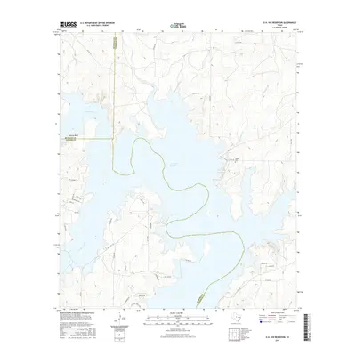
2016 Map of O.H. Ivie Reservoir
USGS Topo · Published 2016About this map
O. H. Ivie Reservoir dominates this Central Texas landscape where the Colorado River and Concho River meet at the intersection of Runnels, Coleman, and Concho Counties. The 2016 survey illustrates the extensive shoreline created by the reservoir, reaching north into Grape Cr and Little Grape Cr. To the east, the water fills the valley of Bull Hollow Br, while the western banks are marked by the prominent elevation of Brushy Bluff.
Find a feature on this map
47 named features on this map. Tap any name to fly to it.
Don’t see what you’re looking for? This feature index may not catch every label — zoom into the map to look around manually.
Map Details
Editions of this 2016 O.H. Ivie Reservoir Map
This is the sole edition of this map. No revisions or reprints were ever made.
Other maps of this area

1892 · Eden
USGS Topo · 1:125,000

1892 · Ballinger
USGS Topo · 1:125,000

1896 · Eden
USGS Topo · 1:125,000

1924 · Eden 1-a
USGS Topo · 1:48,000

1925 · Ballinger 3-d
USGS Topo · 1:48,000

1925 · Ballinger 4-c
USGS Topo · 1:48,000

1931 · Stacy
USGS Topo · 1:62,500

1932 · Voss
USGS Topo · 1:62,500

1932 · Paint Rock
USGS Topo · 1:62,500

1954 · Brownwood
USGS Topo · 1:250,000