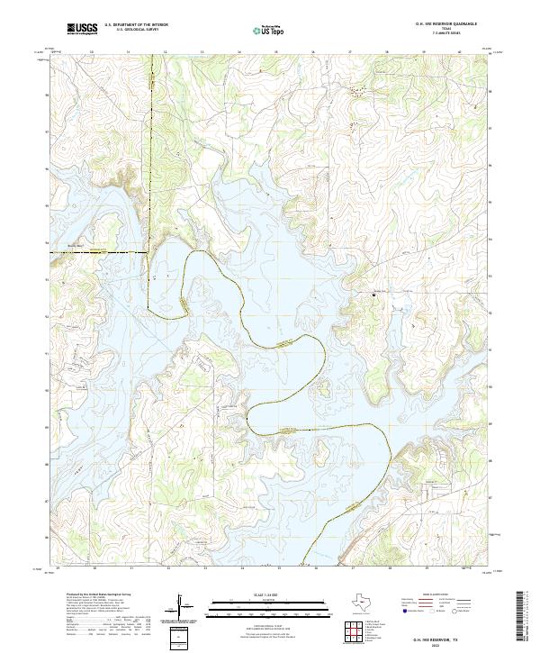
2022 Map of O.H. Ivie Reservoir
USGS Topo · Published 2022About this map
The O. H. Ivie Reservoir dominates this Central Texas landscape at the confluence of the Colorado River and its major tributaries. This modern survey illustrates the expansive water body where the borders of Runnels, Concho, and Coleman counties meet. While much of the low-lying terrain is submerged, historical markers like Leaday Cem remain on the higher ground overlooking Bull Hollow Br. To the west, the settlement of San Clemente sits near the headwaters of several drainages, including Spring Br and Grape Creek. The map details a shift from traditional rural ranching routes to recreation-focused infrastructure, evidenced by residential street developments like Gattling Creek Loop and Turkey Bend Dr along the reservoir's deeply indented shoreline.
Find a feature on this map
46 named features on this map. Tap any name to fly to it.
Don’t see what you’re looking for? This feature index may not catch every label — zoom into the map to look around manually.
Map Details
Editions of this 2022 O.H. Ivie Reservoir Map
This is the sole edition of this map. No revisions or reprints were ever made.
Other maps of this area

1892 · Eden
USGS Topo · 1:125,000

1892 · Ballinger
USGS Topo · 1:125,000

1896 · Eden
USGS Topo · 1:125,000

1924 · Eden 1-a
USGS Topo · 1:48,000

1925 · Ballinger 3-d
USGS Topo · 1:48,000

1925 · Ballinger 4-c
USGS Topo · 1:48,000

1931 · Stacy
USGS Topo · 1:62,500

1932 · Voss
USGS Topo · 1:62,500

1932 · Paint Rock
USGS Topo · 1:62,500

1954 · Brownwood
USGS Topo · 1:250,000