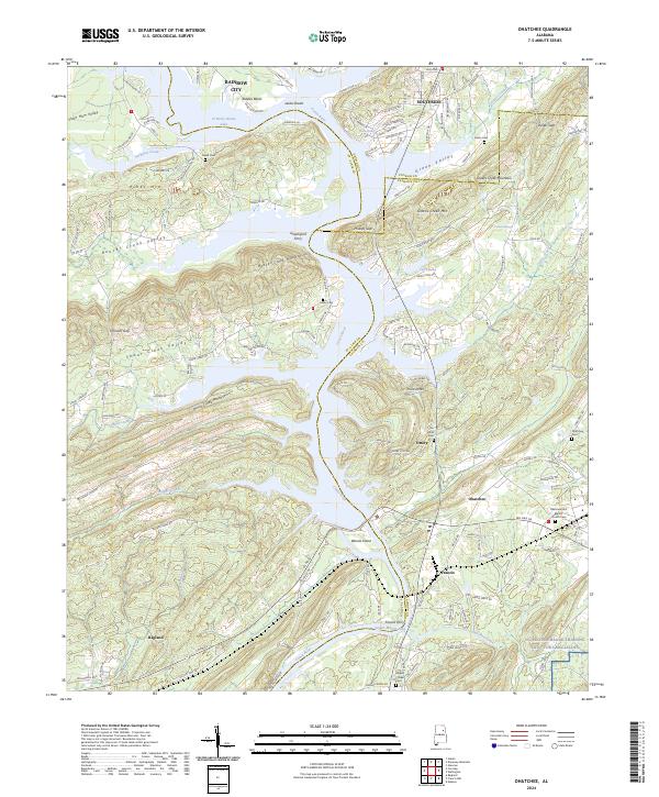
2024 Map of Ohatchee
USGS Topo · Published 2024About this map
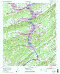
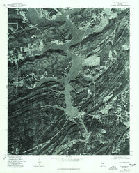
The Coosa River defines this portion of the Alabama landscape, winding between the Beaver Creek Mountains and the Shoal Creek Mountains. This 2024 survey documents a region where modern development in Rainbow City and Southside meets long-established river landings and mountain gaps. The river creates a series of significant impoundments here, including H Neely Henry Lake and Logan Martin Lake, which have reshaped the valley floor around Woods Island. Local history is preserved in several rural burial grounds such as Ten Island Cem and Heald Cem, while the location of Greensport Ferry and Francis Ferry point to earlier modes of river transit. To the southeast, the terrain transitions into the NG/Pelham Range Training Site - Fort McClellan, contrasting the wilder ridges of Mohawk Cliff and Hines Mtn with structured military land use.
Find a feature on this map
137 named features on this map. Tap any name to fly to it.
Don’t see what you’re looking for? This feature index may not catch every label — zoom into the map to look around manually.
Map Details
Editions of this 2024 Ohatchee Map
This is the sole edition of this map. No revisions or reprints were ever made.
Historical Maps of Ragan Chapel Through Time
3 maps found