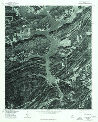
1975 Map of Ohatchee
USGS Topo · Published 1977About this map
H Neely Henry Lake dominates this 1975 orthophotoquad, showcasing the dramatic impoundment of the Coosa River in Calhoun County. The aerial imagery, produced in cooperation with the Soil Conservation Service, provides a rare visual record of the shoreline and forested ridges before further modern development. The settlement of Ohatchee is visible on the eastern bank, positioned where the river begins its southward turn toward Logan Martin Lake. This map is particularly valuable for understanding the mid-1970s land use and the specific engineering of the river system as it existed during this period of Alabama's infrastructure history.
Find a feature on this map
4 named features on this map. Tap any name to fly to it.
Don’t see what you’re looking for? This feature index may not catch every label — zoom into the map to look around manually.
Map Details
Editions of this 1975 Ohatchee Map
This is the sole edition of this map. No revisions or reprints were ever made.
Other maps of this area

1889 · Springville
USGS Topo · 1:125,000

1892 · Springville
USGS Topo · 1:125,000

1900 · Anniston
USGS Topo · 1:125,000

1947 · Cox Gap
USGS Topo · 1:24,000

1947 · Dunaway Mountain
USGS Topo · 1:24,000

1947 · Ragland
USGS Topo · 1:62,500

1947 · Ragland
USGS Topo · 1:24,000

1947 · Glencoe
USGS Topo · 1:24,000

1947 · Wellington
USGS Topo · 1:24,000

1947 · Francis Mill
USGS Topo · 1:24,000