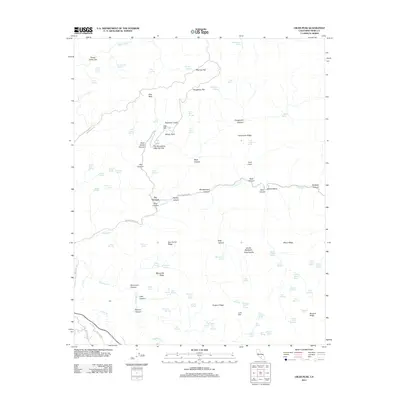
2012 Map of Oiler Peak
USGS Topo · Published 2012About this map
Fig Orchard serves as a central point of human activity in this landscape, situated near the intersection of Oiler Canyon and Caliente Cr. The map reveals a complex network of springs and water sources essential for livestock and settlement, including Land Company Spring and the curiously named Stage Thicket Spring. Evidence of early transit and cattle operations appears in labels like the Teamster Cutoff and Hay Corral Ridge, marking the transition between the lower creek beds and the high elevations of Oiler Peak. The topography is defined by significant ridges and flats, such as Dougherty Flat and Fence Camp Flat, which suggest a history of seasonal grazing. Distinctive geological and trail features like The Horseshoe Little Oak Flat and the Devils Backbone Stag Saddle illustrate the difficult terrain navigated by early travelers along routes like Baker Grade Rd.
Find a feature on this map
96 named features on this map. Tap any name to fly to it.
Don’t see what you’re looking for? This feature index may not catch every label — zoom into the map to look around manually.
Map Details
Editions of this 2012 Oiler Peak Map
This is the sole edition of this map. No revisions or reprints were ever made.
Other maps of this area

1914 · Caliente
USGS Topo · 1:125,000

1915 · Mojave
USGS Topo · 1:125,000

1929 · Bena
USGS Topo · 1:31,680

1930 · Bear Mountain
USGS Topo · 1:31,680

1932 · Bena
USGS Topo · 1:31,680

1933 · Bear Mountain
USGS Topo · 1:31,680

1943 · Tehachapi
USGS Topo · 1:62,500

1943 · Emerald Mtn
USGS Topo · 1:62,500

1943 · Cummings Mountain
USGS Topo · 1:62,500

1943 · Breckenridge Mountain
USGS Topo · 1:62,500