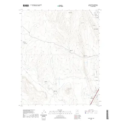
2020 Map of Ojitos Frios
USGS Topo · Published 2020About this map
Ojitos Frios and the surrounding highlands of San Miguel County are defined by a complex network of canyons and drainage systems. This high-altitude landscape is dominated by notable landforms like The Creston and Tecolote Peak, which rise above the surrounding valleys. The map documents the western edge of Las Vegas, where the Luna Community College campus sits near Devils Gulch. Numerous traditional settlements and rural homesteads are connected by roads like Co Rd A19A and Co Rd A20, tracing paths through Lagunas and down to La Manga. Local history is anchored by features such as the La Manga Cem and various seasonal watercourses, including Agua Zarca and Tecolate Cr, which have historically dictated the placement of ranching and residential sites in this part of New Mexico.
Find a feature on this map
40 named features on this map. Tap any name to fly to it.
Don’t see what you’re looking for? This feature index may not catch every label — zoom into the map to look around manually.
Map Details
Editions of this 2020 Ojitos Frios Map
This is the sole edition of this map. No revisions or reprints were ever made.
Other maps of this area

1889 · Las Vegas
USGS Topo · 1:125,000

1890 · Bernal
USGS Topo · 1:125,000

1891 · Bernal
USGS Topo · 1:125,000

1891 · Las Vegas
USGS Topo · 1:125,000

1893 · Las Vegas
USGS Topo · 1:125,000

1894 · Bernal
USGS Topo · 1:125,000

1954 · Santa Fe
USGS Topo · 1:250,000

1958 · Santa Fe
USGS Topo · 1:250,000

1960 · Villanueva
USGS Topo · 1:62,500

1960 · Apache Springs
USGS Topo · 1:62,500