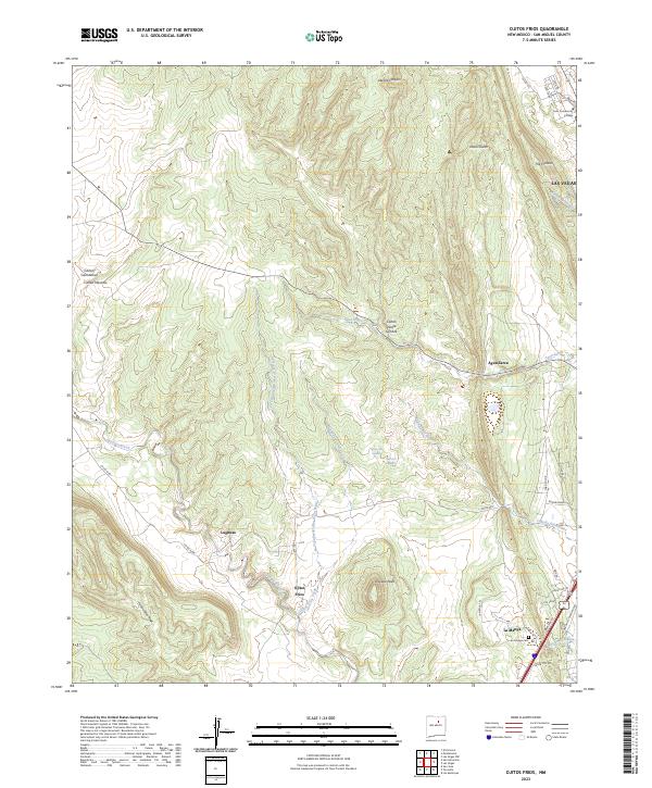
2023 Map of Ojitos Frios
USGS Topo · Published 2023About this map
Tecolote Creek winds through the rugged highlands of San Miguel County, providing a water source that defines the small communities of Lagunas and Ojitos Frios. The landscape is carved by numerous canyons and gulches, including Cañon Piedra Lumbré and Abeyta Canyon, which dictate the local road patterns and land use. On the eastern edge of the quadrangle, the terrain transitions toward the outskirts of Las Vegas, marked by the distinct ridge known as The Creston.
Find a feature on this map
40 named features on this map. Tap any name to fly to it.
Don’t see what you’re looking for? This feature index may not catch every label — zoom into the map to look around manually.
Map Details
Editions of this 2023 Ojitos Frios Map
This is the sole edition of this map. No revisions or reprints were ever made.
Other maps of this area

1889 · Las Vegas
USGS Topo · 1:125,000

1890 · Bernal
USGS Topo · 1:125,000

1891 · Bernal
USGS Topo · 1:125,000

1891 · Las Vegas
USGS Topo · 1:125,000

1893 · Las Vegas
USGS Topo · 1:125,000

1894 · Bernal
USGS Topo · 1:125,000

1954 · Santa Fe
USGS Topo · 1:250,000

1958 · Santa Fe
USGS Topo · 1:250,000

1960 · Villanueva
USGS Topo · 1:62,500

1960 · Apache Springs
USGS Topo · 1:62,500