1971 Map of Olaf Knolls
USGS Topo · Published 1973About this map
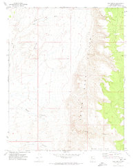
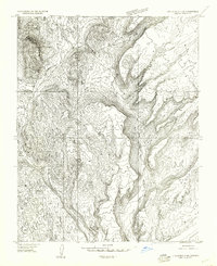
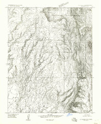
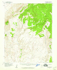
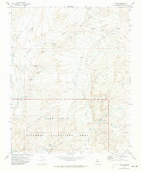
Olaf Knolls rises above a dramatic landscape in northwestern Arizona, defined by sharp elevation shifts and seasonal watercourses. This early 1970s survey captures the intersection of the Grand Wash Cliffs and the broad Grand Gulch Bench, showing a remote region where life is shaped by the scarcity of water. The presence of the Upper Well indicates the critical infrastructure required for ranching or travel in this arid territory. The drainage system is dominated by the Grand Wash, which is fed by complex topographical features like Squaw Canyon and Tank Canyon. This map serves as a vital record of the Mohave County backcountry before modern shifts in land use, documenting the precise landforms and few named water sources that dictated movement across the high desert.
Find a feature on this map
7 named features on this map. Tap any name to fly to it.
Don’t see what you’re looking for? This feature index may not catch every label — zoom into the map to look around manually.
Map Details
Editions of this 1971 Olaf Knolls Map
This is the sole edition of this map. No revisions or reprints were ever made.
Other maps of this area

1886 · Mt. Trumbull
USGS Topo · 1:250,000

1892 · Mt. Trumbull
USGS Topo · 1:250,000

1953 · Grand Canyon
USGS Topo · 1:250,000
1954 · Littlefield 3 SW
USGS Topo · 1:24,000
1954 · Littlefield 3 SE
USGS Topo · 1:24,000
1954 · Cane Springs
USGS Topo · 1:62,500

1957 · Grand Canyon
USGS Topo · 1:250,000

1958 · Grand Canyon
USGS Topo · 1:250,000

1960 · Grand Canyon
USGS Topo · 1:250,000
1971 · Gyp Hills
USGS Topo · 1:24,000