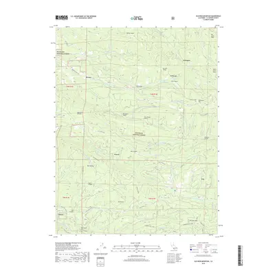
2018 Map of Old Iron Mountain
USGS Topo · Published 2018About this map
Eldorado National Forest encompasses this high-elevation terrain in El Dorado County, defined by a complex network of ridgelines and deep canyons. The landscape is marked by the prominent Iron Mtn Ridge and Old Iron Mtn, where the elevation shapes local transit and settlement patterns. Small clusters and individual sites like Bryants, Griminger, and Bonetti sit tucked between features like Big Pebble Canyon and Little Pebble Canyon. The drainage of the N Fork Cosumnes River and its various tributaries, including Steely Cr and Plum Cr, dictate the movement of historical trails and modern forest roads. Notable for researchers of the area's timber and transit history, the Tonys Gulch Trestle Trail and the Mormon Emigrant Trl offer evidence of how this mountain landscape was navigated throughout the twentieth century.
Find a feature on this map
64 named features on this map. Tap any name to fly to it.
Don’t see what you’re looking for? This feature index may not catch every label — zoom into the map to look around manually.
Map Details
Editions of this 2018 Old Iron Mountain Map
This is the sole edition of this map. No revisions or reprints were ever made.
Other maps of this area

1889 · Pyramid Peak
USGS Topo · 1:125,000

1891 · Placerville
USGS Topo · 1:125,000

1891 · Pyramid Peak
USGS Topo · 1:125,000

1892 · Placerville
USGS Topo · 1:125,000

1893 · Placerville
USGS Topo · 1:125,000

1895 · Pyramid Peak
USGS Topo · 1:125,000

1896 · Pyramid Peak
USGS Topo · 1:125,000

1947 · Sacramento
USGS Topo · 1:250,000

1948 · Sacramento
USGS Topo · 1:250,000

1950 · Riverton
USGS Topo · 1:24,000