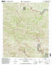
1995 Map of Old Man Mountain
USGS Topo · Published 2000About this map
Old Man Mountain stands as a prominent geographic anchor within this portion of the Los Padres National Forest during the mid-1990s. The landscape is defined by the sharp divide of the Santa Barbara and Ventura County line, tracing high ridges and deep drainages like Sespe Creek and Abadi Creek. Historical land use is visible in the southeastern corner through the boundaries of the Los Prietos y Najalayegua Grant, reflecting the region's ranching heritage. Long-established routes including the Monte Arido Trail and Potrero Seco Trail connect remote points such as Monte Arido and Hartman Ranch. The map also details the protected Matilija Wilderness, where the North Fork Matilija Creek carves through the Bald Hills, providing a clear record of the watershed and terrain as it existed before the turn of the 21st century.
Find a feature on this map
26 named features on this map. Tap any name to fly to it.
Don’t see what you’re looking for? This feature index may not catch every label — zoom into the map to look around manually.
Map Details
Editions of this 1995 Old Man Mountain Map
This is the sole edition of this map. No revisions or reprints were ever made.
Other maps of this area

1902 · Santa Ynez
USGS Topo · 1:125,000

1903 · Mt. Pinos
USGS Topo · 1:125,000

1904 · Ventura
USGS Topo · 1:62,500

1905 · Santa Ynez
USGS Topo · 1:125,000

1941 · Ventura
USGS Topo · 1:62,500

1942 · Wheeler Springs
USGS Topo · 1:24,000

1943 · Rancho Nuevo Creek
USGS Topo · 1:24,000

1943 · Old Man Mountain
USGS Topo · 1:24,000

1943 · Reyes Peak
USGS Topo · 1:24,000

1943 · Wheeler Springs
USGS Topo · 1:24,000