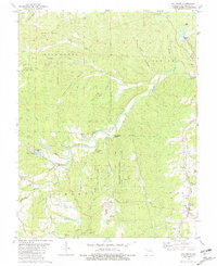
1981 Map of Old Mines
USGS Topo · Published 1981About this map
The Mineral Fork river system carves through this portion of Washington County, defining a landscape of steep hollows and high ridges. The settlement of Old Mines anchors the southeastern corner, reflecting the deep industrial roots of the region with scattered Strip Mine sites and tailings ponds. Further north, the Pea Ridge State Forest covers a significant portion of the terrain, while the Missouri Pacific railroad line tracks along the eastern edge near Racola.
Find a feature on this map
53 named features on this map. Tap any name to fly to it.
Don’t see what you’re looking for? This feature index may not catch every label — zoom into the map to look around manually.
Map Details
Editions of this 1981 Old Mines Map
This is the sole edition of this map. No revisions or reprints were ever made.
Other maps of this area

1901 · De Soto
USGS Topo · 1:125,000

1905 · Bonneterre
USGS Topo · 1:62,500

1906 · Potosi
USGS Topo · 1:62,500

1937 · Fletcher
USGS Topo · 1:24,000

1937 · Tiff
USGS Topo · 1:24,000

1938 · Fletcher
USGS Topo · 1:24,000

1939 · Tiff
USGS Topo · 1:24,000

1946 · Richwoods
USGS Topo · 1:62,500

1948 · Richwoods
USGS Topo · 1:62,500

1949 · Saint Louis
USGS Topo · 1:250,000