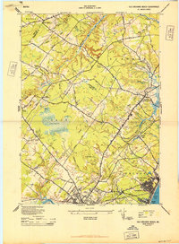
1944 Map of Old Orchard Beach
USGS Topo · Published 1944About this map
The coastal resort community of Old Orchard Beach and its surrounding marshlands are documented here just after the peak of World War II. The landscape is defined by the transition from the sandy shores of Saco Bay to the expansive wetlands of The Heath and the numerous brooks feeding the Nonesuch River and Goosefare Brook. The commercial and social pulse of the era is evident in the cluster of landmarks near the coast, including Ocean Park, a large Campground, and the Outdoor Theatre along the Portland Road. Inland, the map reveals a decentralized network of rural life, marked by one-room schoolhouses like the Flag Pond School and Beech Ridge School, and small industrial sites such as Milliken Mills. The path of the Boston and Maine RR cuts through the territory, linking the settlement at Dunstan with the growing coastal neighborhoods.
Find a feature on this map
86 named features on this map. Tap any name to fly to it.
Don’t see what you’re looking for? This feature index may not catch every label — zoom into the map to look around manually.
Map Details
Editions of this 1944 Old Orchard Beach Map
This is the sole edition of this map. No revisions or reprints were ever made.
Other maps of this area

1891 · Portland
USGS Topo · 1:62,500

1891 · Biddeford
USGS Topo · 1:62,500

1891 · Kennebunk
USGS Topo · 1:62,500

1891 · Buxton
USGS Topo · 1:62,500

1892 · Buxton
USGS Topo · 1:62,500

1893 · Kennebunk
USGS Topo · 1:62,500

1893 · Biddeford
USGS Topo · 1:62,500

1893 · Portland
USGS Topo · 1:62,500

1893 · Buxton
USGS Topo · 1:62,500

1898 · Kennebunk
USGS Topo · 1:62,500