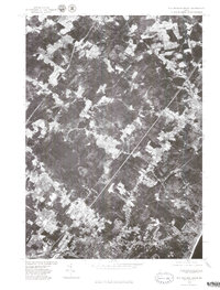
1975 Map of Old Orchard Beach
USGS Topo · Published 1979About this map
Old Orchard Beach is revealed in this mid-1970s orthophotoquad, showing the dense coastal development along the Atlantic shoreline just north of the Saco River. This photographic record, prepared in cooperation with the Soil Conservation Service, documents the transition from the marshy lowlands of the Nonesuch River and Dunstan River to the residential grids of West Scarborough and Boothbay Park. The imagery captures the physical relationship between the established town centers and the natural recreational spaces like Pine Park, providing a clear view of the area's geography before decades of modern coastal expansion. It serves as a precise visual baseline for understanding the land use and drainage patterns of York County during this era.
Find a feature on this map
7 named features on this map. Tap any name to fly to it.
Don’t see what you’re looking for? This feature index may not catch every label — zoom into the map to look around manually.
Map Details
Editions of this 1975 Old Orchard Beach Map
This is the sole edition of this map. No revisions or reprints were ever made.
Other maps of this area

1891 · Portland
USGS Topo · 1:62,500

1891 · Biddeford
USGS Topo · 1:62,500

1891 · Kennebunk
USGS Topo · 1:62,500

1891 · Buxton
USGS Topo · 1:62,500

1892 · Buxton
USGS Topo · 1:62,500

1893 · Kennebunk
USGS Topo · 1:62,500

1893 · Biddeford
USGS Topo · 1:62,500

1893 · Portland
USGS Topo · 1:62,500

1893 · Buxton
USGS Topo · 1:62,500

1898 · Kennebunk
USGS Topo · 1:62,500