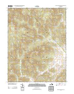
2013 Map of Old Rag Mountain
USGS Topo · Published 2013About this map
Old Rag Mountain dominates this portion of the Blue Ridge, serving as a focal point for a landscape defined by steep hollows and high-elevation overlooks. The map captures a transition from the preserved wilderness of the mountains to the valley floor settlements of Etlan and Nethers. Evidence of early Appalachian life persists through markers like Corbin Cabin and the site of Oldrag, while the surrounding terrain is deeply incised by the Hughes River and the Robinson River.
Find a feature on this map
85 named features on this map. Tap any name to fly to it.
Don’t see what you’re looking for? This feature index may not catch every label — zoom into the map to look around manually.
Map Details
Editions of this 2013 Old Rag Mountain Map
This is the sole edition of this map. No revisions or reprints were ever made.
Other maps of this area

1892 · Gordonsville
USGS Topo · 1:125,000

1893 · Luray
USGS Topo · 1:125,000

1905 · Luray
USGS Topo · 1:125,000

1929 · Stony Man
USGS Topo · 1:48,000

1930 · Madison
USGS Topo · 1:48,000

1933 · Stony Man
USGS Topo · 1:62,500

1933 · Madison
USGS Topo · 1:62,500

1949 · Charlottesville
USGS Topo · 1:250,000

1956 · Charlottesville
USGS Topo · 1:250,000

1961 · Sperryville
USGS Topo · 1:62,500