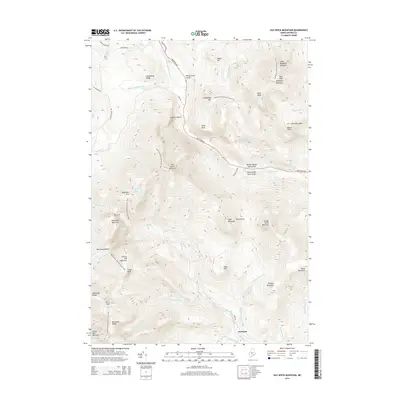
2014 Map of Old Speck Mountain
USGS Topo · Published 2014About this map
Old Speck Mountain stands as the centerpiece of this high-elevation Oxford County landscape, where the Appalachian National Scenic Trail winds through some of Maine's most challenging mountain passes. The terrain is defined by the steep cuts of Grafton Notch and dramatic geological features such as Screw Auger Falls Gorge and Moose Cave Gorge along the Bear River. This 2014 survey captures a wilderness area nearly devoid of modern settlement, with the exception of the remote Ketchum area in the southeast. The map details a complex network of high-altitude water bodies and drainage systems, including Speck Pond and the headwaters of the Swift Cambridge River. Notable landmarks such as Table Rock and the deep cleft of Mahoosuc Notch offer significant points of interest for those studying the physical geography and trail history of the Mahoosuc Range.
Find a feature on this map
63 named features on this map. Tap any name to fly to it.
Don’t see what you’re looking for? This feature index may not catch every label — zoom into the map to look around manually.
Map Details
Editions of this 2014 Old Speck Mountain Map
This is the sole edition of this map. No revisions or reprints were ever made.
Other maps of this area

1893 · Gorham
USGS Topo · 1:62,500

1896 · Gorham
USGS Topo · 1:62,500

1914 · Bethel
USGS Topo · 1:62,500

1930 · Milan
USGS Topo · 1:62,500

1933 · Milan
USGS Topo · 1:62,500

1934 · Milan
USGS Topo · 1:62,500

1937 · Gorham
USGS Topo · 1:48,000

1940 · Bethel
USGS Topo · 1:62,500

1941 · Bethel
USGS Topo · 1:62,500

1942 · Gorham
USGS Topo · 1:62,500
Featured Places
- Newry, ME
- Ketchum, Riley Township
- Grafton Township, ME
- Andover West Surplus Township, ME
- Riley Township, ME