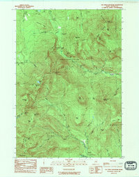
1984 Map of Old Speck Mountain
USGS Topo · Published 1985About this map
Grafton Notch State Park anchors this mid-1980s topographical study of Oxford County, capturing the intricate elevations of the Mahoosuc Range. The map traces the legendary Appalachian Trail as it winds over peaks like Old Speck Mtn and through the notorious Mahoosuc Notch, often cited as a particularly difficult passage. Geologic landmarks such as Moose Cave, Table Rock, and the dramatic cascades at Screw Auger Falls are clearly marked along the Bear River valley.
Find a feature on this map
57 named features on this map. Tap any name to fly to it.
Don’t see what you’re looking for? This feature index may not catch every label — zoom into the map to look around manually.
Map Details
Editions of this 1984 Old Speck Mountain Map
This is the sole edition of this map. No revisions or reprints were ever made.
Other maps of this area

1893 · Gorham
USGS Topo · 1:62,500

1896 · Gorham
USGS Topo · 1:62,500

1914 · Bethel
USGS Topo · 1:62,500

1930 · Milan
USGS Topo · 1:62,500

1933 · Milan
USGS Topo · 1:62,500

1934 · Milan
USGS Topo · 1:62,500

1937 · Gorham
USGS Topo · 1:48,000

1940 · Bethel
USGS Topo · 1:62,500

1941 · Bethel
USGS Topo · 1:62,500

1942 · Gorham
USGS Topo · 1:62,500
Featured Places
- Newry, ME
- Grafton Township, ME
- Andover West Surplus Township, ME
- Riley Township, ME
- Ketchum, Riley Township