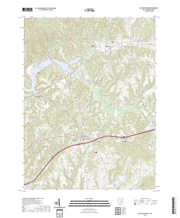
2023 Map of Old Washington
USGS Topo · Published 2023About this map
Old Washington serves as the central hub of this eastern Ohio landscape, situated where historical routes and modern travel ways intersect. The village is surrounded by a dense network of country roads like Cadiz Rd and Easton Rd, reflecting a long-established settlement pattern that persists in the 21st century. To the north, the waters of Salt Fork Lake have transformed the terrain, creating a complex shoreline near Brady and Warrentown while supporting a series of recreational paths including the Blue Trail.
Find a feature on this map
100 named features on this map. Tap any name to fly to it.
Don’t see what you’re looking for? This feature index may not catch every label — zoom into the map to look around manually.
Map Details
Editions of this 2023 Old Washington Map
This is the sole edition of this map. No revisions or reprints were ever made.
Other maps of this area

1909 · Antrim
USGS Topo · 1:48,000

1909 · Summerfield
USGS Topo · 1:62,500

1909 · Cambridge
USGS Topo · 1:62,500

1911 · Antrim
USGS Topo · 1:62,500

1911 · Cumberland
USGS Topo · 1:62,500

1911 · Summerfield
USGS Topo · 1:62,500

1912 · Cambridge
USGS Topo · 1:62,500

1949 · Clarksburg
USGS Topo · 1:250,000

1951 · Canton
USGS Topo · 1:250,000

1953 · Canton
USGS Topo · 1:250,000