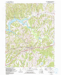
1993 Map of Old Washington
USGS Topo · Published 1993About this map
The village of Old Washington serves as the focal point of this Guernsey County survey, which documents the landscape following several decades of twentieth-century infrastructure development. The arrival of Interstate 70 and the creation of Interchange 186 altered the local topography, yet the map still preserves older landmarks like the Zane Road and the nearby County Fairground. To the north, the waters of Salt Fork Lake and the Salt Fork State Park and Wildlife Area dominate the drainage basin of the Salt Fork.
Find a feature on this map
43 named features on this map. Tap any name to fly to it.
Don’t see what you’re looking for? This feature index may not catch every label — zoom into the map to look around manually.
Map Details
Editions of this 1993 Old Washington Map
This is the sole edition of this map. No revisions or reprints were ever made.
Other maps of this area

1909 · Antrim
USGS Topo · 1:48,000

1909 · Summerfield
USGS Topo · 1:62,500

1909 · Cambridge
USGS Topo · 1:62,500

1911 · Antrim
USGS Topo · 1:62,500

1911 · Cumberland
USGS Topo · 1:62,500

1911 · Summerfield
USGS Topo · 1:62,500

1912 · Cambridge
USGS Topo · 1:62,500

1949 · Clarksburg
USGS Topo · 1:250,000

1951 · Canton
USGS Topo · 1:250,000

1953 · Canton
USGS Topo · 1:250,000