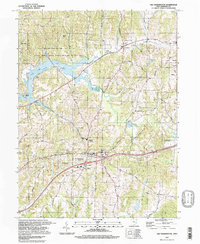
1994 Map of Old Washington
USGS Topo · Published 1998About this map
Salt Fork Lake dominates the northwest quadrant of this Guernsey County survey, its irregular shoreline defined by inlets like Fogle Run and Salt Fork State Park and Wildlife Area. The landscape transitions from the protected lands of the state park and Moore Mem Woods County Park to the established agricultural and residential corridors of Old Washington and Winterset. For local historians, the map preserves the location of rural community hubs including the Buckeye Trail High Sch, Madison Sch, and several houses of worship like the Full Gospel Ch.
Find a feature on this map
55 named features on this map. Tap any name to fly to it.
Don’t see what you’re looking for? This feature index may not catch every label — zoom into the map to look around manually.
Map Details
Editions of this 1994 Old Washington Map
This is the sole edition of this map. No revisions or reprints were ever made.
Other maps of this area

1909 · Antrim
USGS Topo · 1:48,000

1909 · Summerfield
USGS Topo · 1:62,500

1909 · Cambridge
USGS Topo · 1:62,500

1911 · Antrim
USGS Topo · 1:62,500

1911 · Cumberland
USGS Topo · 1:62,500

1911 · Summerfield
USGS Topo · 1:62,500

1912 · Cambridge
USGS Topo · 1:62,500

1949 · Clarksburg
USGS Topo · 1:250,000

1951 · Canton
USGS Topo · 1:250,000

1953 · Canton
USGS Topo · 1:250,000