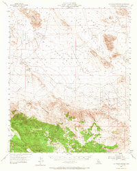
1955 Map of Old Woman Springs
USGS Topo · Published 1966About this map
Old Woman Springs and the expansive desert landscape of Johnson Valley define this mid-century survey of the Mojave’s edge. The map reveals a land structured by its water sources, from the ephemeral basins of Soggy Lake and Melville Lake to critical desert lifelines like Rock Corral Spring and Two Hole Spring. To the south, the terrain climbs sharply into the San Bernardino National Forest, where high points like Granite Peak and Tip Top Mtn oversee a network of deep-cut drainages including Arrastre Canyon and Bighorn Canyon. Human presence is marked by isolated outposts like Parson Ranch and scattered mining activity indicated by several shafts near the Fry Mountains. This document captures the remote character of the high desert before modern expansion, preserving the locations of springs and seasonal lakes that were vital for early travelers and cattlemen in San Bernardino County.
Find a feature on this map
28 named features on this map. Tap any name to fly to it.
Don’t see what you’re looking for? This feature index may not catch every label — zoom into the map to look around manually.
Map Details
Editions of this 1955 Old Woman Springs Map
3 editions found
Other maps of this area

1901 · Southern California Sheet No. 1
USGS Topo · 1:250,000

1902 · San Gorgonio
USGS Topo · 1:125,000

1904 · Southern California Sheet No. 1
USGS Topo · 1:250,000

1947 · Lucerne Valley
USGS Topo · 1:62,500

1949 · Lucerne Valley
USGS Topo · 1:62,500

1953 · San Bernardino
USGS Topo · 1:250,000

1954 · Galway Lake
USGS Topo · 1:24,000

1954 · Emerson Lake
USGS Topo · 1:24,000

1954 · San Gorgonio Mountain
USGS Topo · 1:62,500

1955 · Old Woman Springs
USGS Topo · 1:62,500