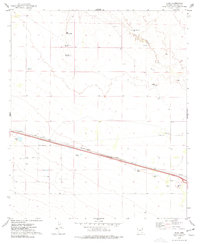
1974 Map of Olga
USGS Topo · Published 1977About this map
Olga and the surrounding high desert of Cochise County are defined by a sparse network of ranching and transportation infrastructure. The Southern Pacific railroad corridor serves as the primary east-west artery, running parallel to a major Pipeline and service roads. This industrial spine cuts through an arid landscape where water management is critical, as evidenced by the presence of the Olga Detention Dam, West Well Detention Dam, and several designated wells like New Well and West Well.
Find a feature on this map
17 named features on this map. Tap any name to fly to it.
Don’t see what you’re looking for? This feature index may not catch every label — zoom into the map to look around manually.
Map Details
Editions of this 1974 Olga Map
This is the sole edition of this map. No revisions or reprints were ever made.
Other maps of this area

1917 · San Simon
USGS Topo · 1:125,000

1926 · Cochise Head
USGS Topo · 1:62,500

1926 · Orange Butte
USGS Topo · 1:62,500

1928 · Chenoweth
USGS Topo · 1:62,500

1928 · Bowie
USGS Topo · 1:62,500

1949 · Bowie
USGS Topo · 1:62,500

1950 · San Simon
USGS Topo · 1:62,500

1950 · Bowie
USGS Topo · 1:62,500

1950 · Cochise Head
USGS Topo · 1:62,500

1950 · Vanar
USGS Topo · 1:62,500