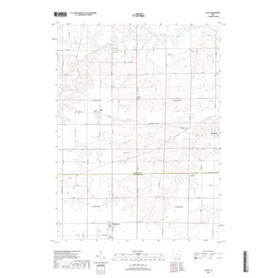
2018 Map of Ollie
USGS Topo · Published 2018About this map
Richland and Ollie anchor the upper portion of this topographic study, where the fertile plains of the Iowa heartland meet the winding corridors of the South Skunk River and Skunk River. This landscape is defined by its deep agricultural roots, visible in the intricate network of section roads like Co Hwy V67 and the small, scattered community centers that characterize Keokuk and Jefferson counties. The settlement of Packwood sits near the southern boundary, further illustrating the dispersed rural development pattern of the region.
Find a feature on this map
47 named features on this map. Tap any name to fly to it.
Don’t see what you’re looking for? This feature index may not catch every label — zoom into the map to look around manually.
Map Details
Editions of this 2018 Ollie Map
This is the sole edition of this map. No revisions or reprints were ever made.
Other maps of this area

1954 · Des Moines
USGS Topo · 1:250,000

1956 · Des Moines
USGS Topo · 1:250,000

1957 · Des Moines
USGS Topo · 1:250,000

1958 · Davenport
USGS Topo · 1:250,000

1961 · Davenport
USGS Topo · 1:250,000

1962 · Davenport
USGS Topo · 1:250,000

1965 · Harper
USGS Topo · 1:24,000

1965 · Sigourney
USGS Topo · 1:24,000

1969 · Des Moines
USGS Topo · 1:250,000
1973 · Keota
USGS Topo · 1:24,000