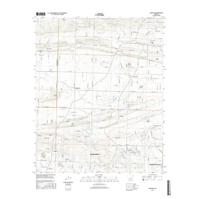
2017 Map of Olmstead
USGS Topo · Published 2017About this map
Sherwood and Jacksonville anchor the southern portion of this landscape, where suburban growth meets the expansive Little Rock Air Force Base. The terrain is defined by a series of ridges and hills, including Frenchman Mountain, Backbone Ridge, and Wilson Knob, which rise above the winding path of Bayou Meto. To the north, smaller rural communities like Olmstead, Warsaw, and Macon maintain a more dispersed settlement pattern. For those researching local heritage, the map identifies several significant landmarks including Harmony Cem, Gibson Cem, and Mount Valley Cem. The hydrologic network is dense, featuring numerous small bodies of water such as Hatcher Lake Number One, Thomas Lake, and Faulkner Lake, many of which are situated along the lowlands of Cypress Br and Jacks Bayou. This survey reflects the varied land use of the county, balancing military installation, residential expansion, and the natural drainage systems of central Arkansas.
Find a feature on this map
212 named features on this map. Tap any name to fly to it.
Don’t see what you’re looking for? This feature index may not catch every label — zoom into the map to look around manually.
Map Details
Editions of this 2017 Olmstead Map
This is the sole edition of this map. No revisions or reprints were ever made.
Other maps of this area

1891 · Little Rock
USGS Topo · 1:125,000

1893 · Little Rock
USGS Topo · 1:125,000

1935 · Mc Almont
USGS Topo · 1:24,000

1935 · North Little Rock
USGS Topo · 1:24,000

1941 · Olmstead
USGS Topo · 1:31,680

1941 · Cabot
USGS Topo · 1:31,680

1943 · Jacksonville
USGS Topo · 1:31,680

1953 · Cato
USGS Topo · 1:24,000

1954 · Mc Almont
USGS Topo · 1:24,000

1954 · Olmstead
USGS Topo · 1:24,000