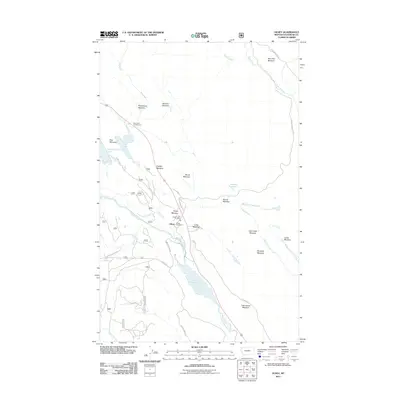
2011 Map of Olney
USGS Topo · Published 2011About this map
Olney serves as the central hub of this Flathead County landscape, where the Olney Post Office and Olney Rural Fire Dist anchor a small community within a wider network of timberlands and meadows. The geography is defined by the Stillwater River drainage, connecting the distinctive Upper Stillwater Lake and Lower Stillwater Lake. This region is characterized by its numerous named open spaces, including Purple Meadow, Ritsenburg Meadow, and Lake House Meadow, which suggest a history of seasonal grazing or logging clearings. The map detail follows the paths of Dog Creek and Martin Creek, illustrating how the Olney Crossover Rd and Martin Camp Rd provide access to the surrounding peaks, such as Dog Mountain. Recreational footprints are evident at the Dog Creek Campground, highlighting the area's transition into a destination for outdoorsmen and conservation.
Find a feature on this map
35 named features on this map. Tap any name to fly to it.
Don’t see what you’re looking for? This feature index may not catch every label — zoom into the map to look around manually.
Map Details
Editions of this 2011 Olney Map
This is the sole edition of this map. No revisions or reprints were ever made.
Other maps of this area

1906 · Kintla Lakes
USGS Topo · 1:125,000

1913 · Stryker
USGS Topo · 1:125,000

1916 · Stryker
USGS Topo · 1:125,000

1938 · Kintla Lakes
USGS Topo · 1:125,000

1943 · Kalispell
USGS Topo · 1:125,000

1957 · Kalispell
USGS Topo · 1:250,000

1960 · Kalispell
USGS Topo · 1:250,000

1961 · Kalispell
USGS Topo · 1:250,000

1962 · Johnson Peak
USGS Topo · 1:24,000

1962 · Beaver Lake
USGS Topo · 1:24,000