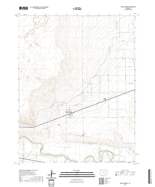
2022 Map of Olney Springs
USGS Topo · Published 2022About this map
Olney Springs serves as the primary hub of this high-plains landscape, where the agricultural economy is strictly defined by an intricate network of irrigation engineering. The town sits at the intersection of Warner Ave and the railroad, south of its namesake Olney Springs Reservoir. The map reveals the critical importance of water management in Crowley County, illustrating a dense system of man-made waterways including the Colorado Canal, the Olney Wasteway, and several lateral branches like the Drescher Lateral and Dayton Lateral. To the south, the terrain descends through Hungerford Hollow toward the Arkansas River, which forms the boundary with Otero County. This river corridor stands in contrast to the rigid section-line road grid that dominates the northern plains, where small clusters like King Center mark the persistence of local crossroads communities.
Find a feature on this map
47 named features on this map. Tap any name to fly to it.
Don’t see what you’re looking for? This feature index may not catch every label — zoom into the map to look around manually.
Map Details
Editions of this 2022 Olney Springs Map
This is the sole edition of this map. No revisions or reprints were ever made.
Other maps of this area

1891 · Catlin
USGS Topo · 1:125,000

1891 · Nepesta
USGS Topo · 1:125,000

1893 · Nepesta
USGS Topo · 1:125,000

1893 · Catlin
USGS Topo · 1:125,000

1904 · Nepesta
USGS Topo · 1:125,000

1954 · Olney Springs
USGS Topo · 1:24,000

1954 · Elder
USGS Topo · 1:24,000

1954 · Ordway
USGS Topo · 1:24,000

1954 · Manzanola
USGS Topo · 1:24,000

1954 · Lamar
USGS Topo · 1:250,000