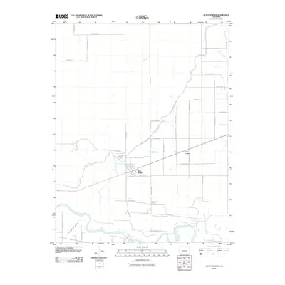
2010 Map of Olney Springs
USGS Topo · Published 2010About this map
Olney Springs serves as the primary hub of this high plains agricultural landscape, where a sophisticated network of man-made waterways supports life above the northern banks of the Arkansas River. The grid of county roads is interrupted by the winding paths of the Colorado Canal and several specialized irrigation features, including the Bradbury Lateral and Lightburn Lateral. These canals illustrate the historical reliance on water management in Crowley County, drawing from the river system to feed the local economy.
Find a feature on this map
49 named features on this map. Tap any name to fly to it.
Don’t see what you’re looking for? This feature index may not catch every label — zoom into the map to look around manually.
Map Details
Editions of this 2010 Olney Springs Map
This is the sole edition of this map. No revisions or reprints were ever made.
Other maps of this area

1891 · Catlin
USGS Topo · 1:125,000

1891 · Nepesta
USGS Topo · 1:125,000

1893 · Nepesta
USGS Topo · 1:125,000

1893 · Catlin
USGS Topo · 1:125,000

1904 · Nepesta
USGS Topo · 1:125,000

1954 · Olney Springs
USGS Topo · 1:24,000

1954 · Elder
USGS Topo · 1:24,000

1954 · Ordway
USGS Topo · 1:24,000

1954 · Manzanola
USGS Topo · 1:24,000

1954 · Lamar
USGS Topo · 1:250,000