
1954 Map of Elder
USGS Topo · Published 1956About this map
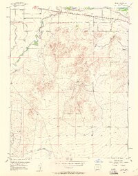
The Arkansas River corridor in Otero County is defined here by a sophisticated network of irrigation systems and transportation routes. Water management is the primary driver of the local landscape, evidenced by the prominent Catlin Canal, Otero Canal, and the Farmers Oxford Ditch, which parallel the river and the Atchison Topeka and Santa Fe railroad line. South of the river valley, the terrain rises into the distinctive Apishapa Bluff and Apishapa Mesa No 2, where the Apishapa River meanders toward its confluence.
Find a feature on this map
21 named features on this map. Tap any name to fly to it.
Don’t see what you’re looking for? This feature index may not catch every label — zoom into the map to look around manually.
Map Details
Editions of this 1954 Elder Map
3 editions found
Other maps of this area

1891 · Catlin
USGS Topo · 1:125,000

1891 · Timpas
USGS Topo · 1:125,000

1891 · Nepesta
USGS Topo · 1:125,000

1891 · Apishapa
USGS Topo · 1:125,000

1893 · Nepesta
USGS Topo · 1:125,000

1893 · Apishapa
USGS Topo · 1:125,000

1893 · Catlin
USGS Topo · 1:125,000

1894 · Timpas
USGS Topo · 1:125,000

1897 · Apishapa
USGS Topo · 1:125,000

1904 · Nepesta
USGS Topo · 1:125,000