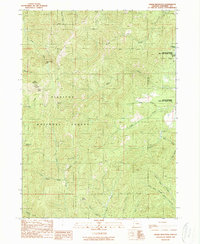
1989 Map of Onion Mountain
USGS Topo · Published 1989About this map
Siskiyou National Forest dominates this 1989 provisional survey of Josephine County, revealing a landscape defined by resource extraction and rugged geography. Industrial history is evident in the presence of the Flanagan Mine, Buckeye Mine, and Ramsey Mine, as well as a large Quarry situated near the center of the quadrangle. The northeastern corner of the map captures a section of the Rogue River, designated here as the Rogue National Wild and Scenic River. The terrain is marked by numerous water sources, including Taylor Creek Falls and a series of named springs like Annie Spring and Root Spring. From the summit of Onion Mountain to the Shan Creek Viewpoint, the map documents the network of timber access roads and forest boundaries that shaped the region's late-twentieth-century character.
Find a feature on this map
30 named features on this map. Tap any name to fly to it.
Don’t see what you’re looking for? This feature index may not catch every label — zoom into the map to look around manually.
Map Details
Editions of this 1989 Onion Mountain Map
This is the sole edition of this map. No revisions or reprints were ever made.
Other maps of this area

1904 · Riddle
USGS Topo · 1:125,000

1908 · Grants Pass
USGS Topo · 1:125,000

1917 · Kerby
USGS Topo · 1:125,000

1918 · Kerby
USGS Topo · 1:125,000

1945 · Kerby
USGS Topo · 1:125,000

1946 · Galice
USGS Topo · 1:62,500

1948 · Galice
USGS Topo · 1:62,500

1954 · Glendale
USGS Topo · 1:62,500

1954 · Selma
USGS Topo · 1:62,500

1954 · Grants Pass
USGS Topo · 1:62,500