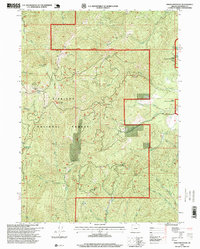
1996 Map of Onion Mountain
USGS Topo · Published 1999About this map
Siskiyou National Forest land dominates this landscape, characterized by heavy mining activity and rugged watersheds. Evidence of the region’s extractive history is visible through the Buckeye Mine, Ramsey Mine, and the Flanagan Mine located near the Rogue River. These operations, alongside multiple labeled prospects and a Quarry, show the intensity of geological exploration in the late 20th century.
Find a feature on this map
40 named features on this map. Tap any name to fly to it.
Don’t see what you’re looking for? This feature index may not catch every label — zoom into the map to look around manually.
Map Details
Editions of this 1996 Onion Mountain Map
This is the sole edition of this map. No revisions or reprints were ever made.
Other maps of this area

1904 · Riddle
USGS Topo · 1:125,000

1908 · Grants Pass
USGS Topo · 1:125,000

1917 · Kerby
USGS Topo · 1:125,000

1918 · Kerby
USGS Topo · 1:125,000

1945 · Kerby
USGS Topo · 1:125,000

1946 · Galice
USGS Topo · 1:62,500

1948 · Galice
USGS Topo · 1:62,500

1954 · Glendale
USGS Topo · 1:62,500

1954 · Selma
USGS Topo · 1:62,500

1954 · Grants Pass
USGS Topo · 1:62,500