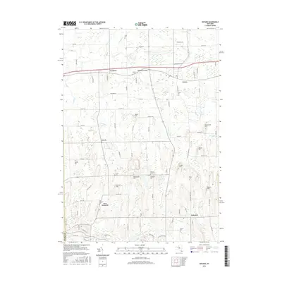
2016 Map of Ontario
USGS Topo · Published 2016About this map
The Monroe and Wayne County border divides this 2016 survey, a landscape where small hamlets are connected by a grid of farm roads and modern corridors. In the north, Fruitland and Ontario Center sit along the east-west route of State Route 104, while the southern portion of the map is defined by the settlement of Walworth and its neighbor West Walworth. These communities are surrounded by a cluster of notable topographical features, including Negro Hill, Kuttruff Hill, and Freewill Hill.
Find a feature on this map
88 named features on this map. Tap any name to fly to it.
Don’t see what you’re looking for? This feature index may not catch every label — zoom into the map to look around manually.
Map Details
Editions of this 2016 Ontario Map
This is the sole edition of this map. No revisions or reprints were ever made.
Other maps of this area
1899 · Palmyra
USGS Topo · 1:62,500
1900 · Macedon
USGS Topo · 1:62,500
1902 · Pultneyville
USGS Topo · 1:62,500
1902 · Palmyra
USGS Topo · 1:62,500
1932 · Webster
USGS Topo · 1:24,000
1932 · Fairport
USGS Topo · 1:24,000
1934 · Fairport
USGS Topo · 1:24,000
1934 · Ninemile Point
USGS Topo · 1:24,000
1934 · Webster
USGS Topo · 1:24,000
1942 · Ontario
USGS Topo · 1:31,680