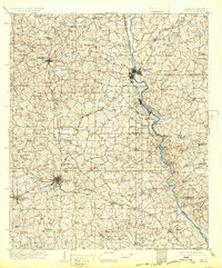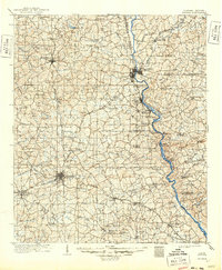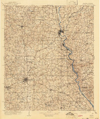
1909 Map of Opelika
USGS Topo · Published 1943About this map
The Chattahoochee River defines the border between Alabama and Georgia in this early 20th-century topographic survey, showing a landscape deeply shaped by river crossings and rail corridors. While Opelika and Lafayette stand as established hubs, the surrounding countryside is dotted with critical small-scale industrial sites and river infrastructure like Houston Ferry and Dixon Ferry. The map captures a moment when local post offices and community landmarks such as Antioch Church (Huckabee PO) and McKinney Mill served as the primary social and economic anchors for rural residents.
Find a feature on this map
88 named features on this map. Tap any name to fly to it.
Don’t see what you’re looking for? This feature index may not catch every label — zoom into the map to look around manually.
Map Details
Editions of this 1909 Opelika Map
4 editions found