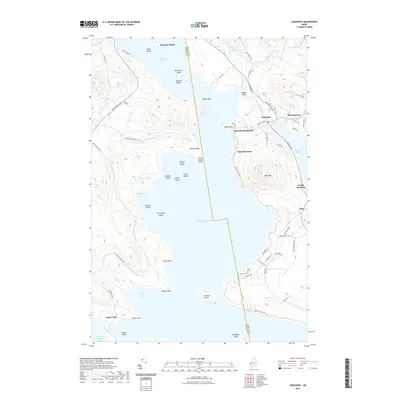
2021 Map of Oquossoc
USGS Topo · Published 2021About this map
Mooselookmeguntic Lake and Rangeley Lake dominate this portion of the Maine highlands, where water and land intertwine at the junction of Franklin Co and Oxford Co. The settlement at Oquossoc serves as a central hub between these major water bodies, with the Rangeley River providing a hydrologic connection. To the south, the prominent mass of Bald Mountain rises between the lakes, while the western shore of Mooselookmeguntic Lake is dotted with numerous landforms like Students Island, Birch Point, and Brandy Point.
Find a feature on this map
77 named features on this map. Tap any name to fly to it.
Don’t see what you’re looking for? This feature index may not catch every label — zoom into the map to look around manually.
Map Details
Editions of this 2021 Oquossoc Map
This is the sole edition of this map. No revisions or reprints were ever made.
Other maps of this area

1931 · Cupsuptic
USGS Topo · 1:48,000

1932 · Kennebago Lake
USGS Topo · 1:48,000

1933 · Rangeley
USGS Topo · 1:48,000

1934 · Cupsuptic
USGS Topo · 1:62,500

1935 · Kennebago Lake
USGS Topo · 1:62,500

1935 · Cupsuptic
USGS Topo · 1:62,500

1936 · Kennebago Lake
USGS Topo · 1:62,500

1939 · Rangeley
USGS Topo · 1:62,500

1940 · Oquossoc
USGS Topo · 1:62,500

1942 · Oquossoc
USGS Topo · 1:62,500
Featured Places
- Rangeley, ME
- Rangeley Plantation, ME
- Adamstown Township, ME
- Upper Dam, Richardsontown Township
- Richardsontown Township, ME