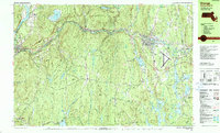
1990 Map of Orange
USGS Topo · Published 1990About this map
The Millers River corridor carves a path through the wooded highlands of Franklin County, serving as the industrial and transit spine for settlements like Erving, Farley, and Orange. By the 1990s, the landscape reflects a century of conservation, with vast tracts designated as Erving State Forest, Wendell State Forest, and Montague State Forest. This survey captures the transition from manufacturing to recreation and forestry, showing the Boston and Maine RR following the river bends while the Mohawk Trail provides road access through the hills.
Find a feature on this map
72 named features on this map. Tap any name to fly to it.
Don’t see what you’re looking for? This feature index may not catch every label — zoom into the map to look around manually.
Map Details
Editions of this 1990 Orange Map
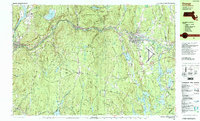
2 editions found
Other maps of this area

1885 · Northampton
USGS Topo · 1:62,500

1886 · Northampton
USGS Topo · 1:62,500

1887 · Warwick
USGS Topo · 1:62,500

1887 · Belchertown
USGS Topo · 1:62,500

1887 · Winchendon
USGS Topo · 1:62,500

1887 · Barre
USGS Topo · 1:62,500

1889 · Barre
USGS Topo · 1:62,500

1889 · Warwick
USGS Topo · 1:62,500

1890 · Belchertown
USGS Topo · 1:62,500

1890 · Greenfield
USGS Topo · 1:62,500