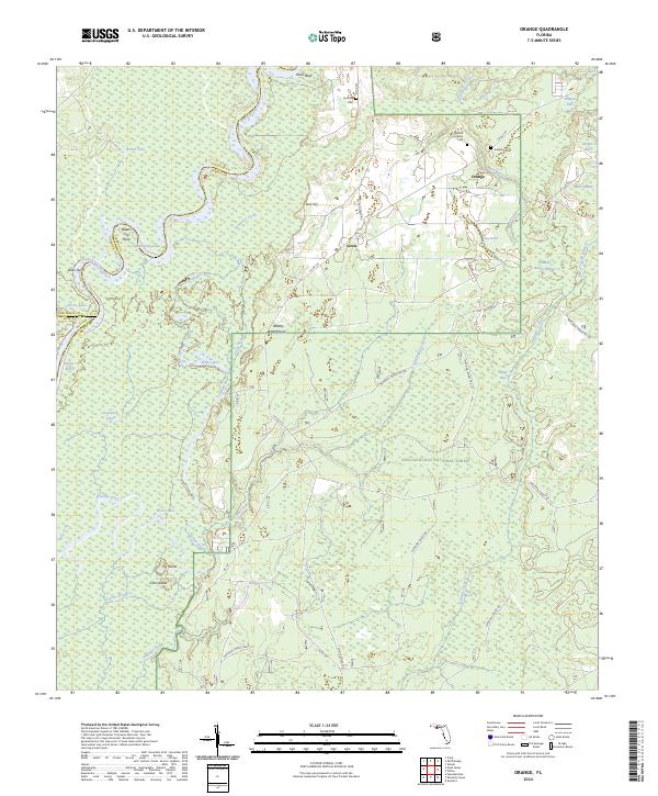
2024 Map of Orange
USGS Topo · Published 2024About this map
The Apalachicola River winds through a complex network of wetlands and swamps along the border of Calhoun and Liberty counties. This riverine landscape is defined by its intricate hydrology, where Everett Slough, Larkin Slough, and Finns Slough create a labyrinth of waterways feeding into the main channel. Elevated terrain features like Ricko Bluff and Red Hill provide contrast to the low-lying Devils Swamp and Juniper Swamp.
Find a feature on this map
56 named features on this map. Tap any name to fly to it.
Don’t see what you’re looking for? This feature index may not catch every label — zoom into the map to look around manually.
Map Details
Editions of this 2024 Orange Map
This is the sole edition of this map. No revisions or reprints were ever made.
Other maps of this area

1945 · Dead Lake
USGS Topo · 1:31,680

1945 · Kennedy Creek
USGS Topo · 1:31,680

1945 · Estiffanulga
USGS Topo · 1:31,680

1945 · Orange
USGS Topo · 1:31,680

1945 · Frink
USGS Topo · 1:31,680

1945 · Wewahitchka
USGS Topo · 1:31,680

1945 · Woods
USGS Topo · 1:31,680

1946 · Sumatra
USGS Topo · 1:31,680
1946 · Wilma
USGS Topo · 1:31,680

1954 · Tallahassee
USGS Topo · 1:250,000