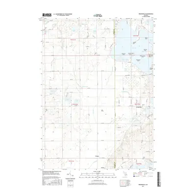
2017 Map of Orangeville
USGS Topo · Published 2017About this map
Orangeville sits as the central settlement in this portion of Barry County, positioned near the waters of Orangeville Cr and the Mill Pond. The landscape is defined by the expansive Gun Lake, featuring several named points and islands such as Englands Point, Yankee Springs Island, and Blackbird Island. This 2017 survey reveals a high density of rural burial grounds, including the Oak Hill Cem near town and several family-named sites like Messer Cem and Lindsey Cem, which serve as vital markers for genealogical research. The Gun River drains the central corridor of the Gun Plains, flowing south toward the smaller communities of Hooper and Neeley. The map details a transition from the lake-oriented recreation areas in the northeast to the structured agricultural grid of the southwest, interconnected by an extensive network of numeric avenues and rural roads.
Find a feature on this map
106 named features on this map. Tap any name to fly to it.
Don’t see what you’re looking for? This feature index may not catch every label — zoom into the map to look around manually.
Map Details
Editions of this 2017 Orangeville Map
This is the sole edition of this map. No revisions or reprints were ever made.
Other maps of this area

1916 · Kalamazoo
USGS Topo · 1:62,500

1918 · Kalamazoo
USGS Topo · 1:62,500

1918 · Galesburg
USGS Topo · 1:62,500

1943 · Kalamazoo
USGS Topo · 1:62,500

1944 · Galesburg
USGS Topo · 1:62,500

1947 · Delton
USGS Topo · 1:24,000

1947 · Galesburg
USGS Topo · 1:62,500

1950 · Galesburg
USGS Topo · 1:62,500

1951 · Hastings
USGS Topo · 1:62,500

1958 · Grand Rapids
USGS Topo · 1:250,000