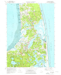
1974 Map of Orleans
USGS Topo · Published 1976About this map
The coastal transition of the Outer Cape is defined here by the established communities of Orleans and Eastham during a period of significant preservation. Much of the Atlantic frontage is protected within the Cape Cod National Seashore, maintaining the integrity of landmarks like Nauset Light and the marshes of Nauset Bay. Further south, the wooded expanse of Nickerson State Forest Park is peppered with freshwater kettle ponds such as Cliff Pond and Flax Pond. The map reveals a landscape deeply connected to its maritime roots, from the Penn Central rail line cutting through the peninsula to the numerous town landings and marshes like Boat Meadow Bog. Residential growth is evident in settlements like Nauset Heights and North Eastham, while historical sites like Fort Hill and Soldiers Cem provide touchpoints for local genealogy and heritage research.
Find a feature on this map
132 named features on this map. Tap any name to fly to it.
Don’t see what you’re looking for? This feature index may not catch every label — zoom into the map to look around manually.
Map Details
Editions of this 1974 Orleans Map
3 editions found
Other maps of this area

1887 · Wellfleet
USGS Topo · 1:62,500

1887 · Yarmouth
USGS Topo · 1:62,500

1888 · Chatham
USGS Topo · 1:62,500

1889 · Yarmouth
USGS Topo · 1:62,500

1889 · Wellfleet
USGS Topo · 1:62,500

1893 · Chatham
USGS Topo · 1:62,500

1893 · Yarmouth
USGS Topo · 1:62,500

1893 · Wellfleet
USGS Topo · 1:62,500

1917 · Chatham
USGS Topo · 1:62,500

1942 · Cape Cod Bay
USGS Topo · 1:125,000