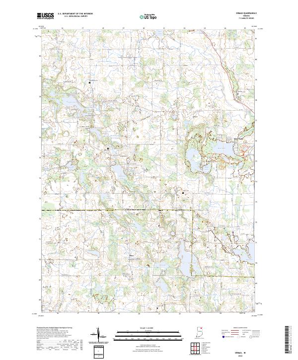
2022 Map of Ormas
USGS Topo · Published 2022About this map
The Tippecanoe River meanders through a landscape defined by glacial lakes and small rural settlements at the border of Noble and Whitley counties. The small communities of Ormas and Etna serve as central points in a region characterized by numerous water bodies, including Bear Lake, High Lake, and the connected waters of Knapp Lake and Little Knapp Lake. For those tracing local family history, several burial grounds are scattered across the townships, such as Broadway Cem, Wolflake Cem, and Thorn Cem. The presence of the Merry Lea Preserve Trl near the Noble-Whitley line highlights the preserved natural spaces surrounding High Lake. A dense network of local roads, such as Lincolnway S and W Baseline Rd, connects these scattered homesteads and lakeside properties, reflecting the area's development as a rural residential and recreational hub.
Find a feature on this map
95 named features on this map. Tap any name to fly to it.
Don’t see what you’re looking for? This feature index may not catch every label — zoom into the map to look around manually.
Map Details
Editions of this 2022 Ormas Map
This is the sole edition of this map. No revisions or reprints were ever made.
Other maps of this area

1950 · Pierceton
USGS Topo · 1:24,000

1950 · North Webster
USGS Topo · 1:24,000

1951 · Wawasee
USGS Topo · 1:24,000

1951 · Ormas
USGS Topo · 1:24,000

1951 · Merriam
USGS Topo · 1:24,000

1953 · Fort Wayne
USGS Topo · 1:250,000

1955 · Columbia City
USGS Topo · 1:24,000

1956 · Fort Wayne
USGS Topo · 1:250,000

1956 · Ligonier
USGS Topo · 1:24,000

1956 · Lorane
USGS Topo · 1:24,000