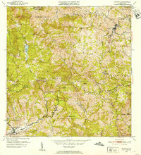
1952 Map of Orocovis
USGS Topo · Published 1953About this map
Orocovis sits at the center of this 1952 study, which captures the central mountain landscape of Puerto Rico during a period of transition in its agricultural and civic development. The map details a network of barrios including Damian Arriba, Pellejas, and Hato Puerco Arriba, illustrating the dispersed settlement patterns typical of the era. Public works and social infrastructure are evident through the labeling of the Escuela Segunda Unidad de Bauta and the Capilla de San Jose. Significant water resources like Lago de Matrullas and the headwaters of the Rio Toa Vaca dominate the southern and western portions of the sheet. Local landmarks such as Cerro Dona Juana and the Hacienda Limon provide specific points of reference for genealogists tracing family roots in these coffee-growing and agricultural highlands.
Find a feature on this map
64 named features on this map. Tap any name to fly to it.
Don’t see what you’re looking for? This feature index may not catch every label — zoom into the map to look around manually.
Map Details
Editions of this 1952 Orocovis Map
2 editions found
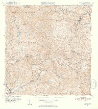
Other maps of this area

1945 · Ponce
USGS Topo · 1:30,000

1945 · Rio Descalabrado
USGS Topo · 1:30,000

1946 · Coamo
USGS Topo · 1:30,000

1946 · Corozal
USGS Topo · 1:30,000

1946 · Barranquitas
USGS Topo · 1:30,000

1946 · Ciales
USGS Topo · 1:30,000

1946 · Jayuya
USGS Topo · 1:30,000

1946 · Florida
USGS Topo · 1:30,000

1946 · Orocovis
USGS Topo · 1:30,000

1947 · Corozal SO
USGS Topo · 1:10,000