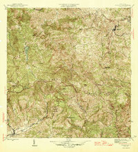
1946 Map of Orocovis
USGS Topo · Published 1946About this map
Orocovis and Villalba anchor this mid-1940s topographic study of the central mountain interior, where the Cordillera Central ridge forms a natural boundary between several municipalities. The landscape is defined by its numerous peaks, including Cerro Doña Juana, Cerro Mime, and Cerro El Bolo, which overlook a complex network of waterways like the Río Bauta and Río Jacaguas. A notable landmark of local water infrastructure is Lago de Matrullas, situated in the northwest.
Find a feature on this map
37 named features on this map. Tap any name to fly to it.
Don’t see what you’re looking for? This feature index may not catch every label — zoom into the map to look around manually.
Map Details
Editions of this 1946 Orocovis Map
3 editions found
Other maps of this area

1945 · Ponce
USGS Topo · 1:30,000

1945 · Rio Descalabrado
USGS Topo · 1:30,000

1946 · Coamo
USGS Topo · 1:30,000

1946 · Corozal
USGS Topo · 1:30,000

1946 · Barranquitas
USGS Topo · 1:30,000

1946 · Ciales
USGS Topo · 1:30,000

1946 · Jayuya
USGS Topo · 1:30,000

1946 · Florida
USGS Topo · 1:30,000

1946 · Orocovis
USGS Topo · 1:30,000

1947 · Corozal SO
USGS Topo · 1:10,000