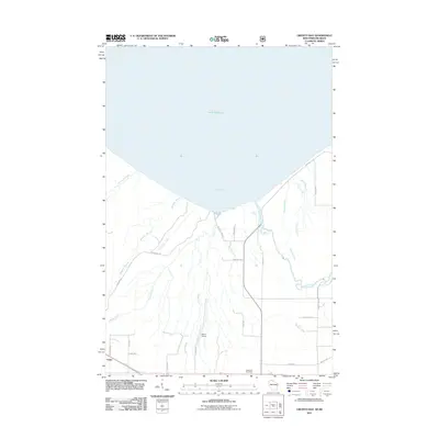
2011 Map of Oronto Bay
USGS Topo · Published 2011About this map
Oronto Bay dominates the northern reaches of this coastal landscape, where the cold waters of Lake Superior meet the Iron County shoreline. This terrain is defined by its deep hydrography, notably the Montreal River which marks the state boundary and features both Superior Falls and Saxon Falls. Near the lakefront, the small cove of Saxon Harbor provides a focal point for maritime access amidst a network of drainage ways like Graveyard Creek and Oronto Creek. To the south, the settlement of Cedar and the Saxon Airport reflect the rural development of the region. Local history is anchored by the Lake View Cemetery and a grid of family-named roads such as Sands Rd and Moncher Rd, tracing the legacy of those who settled this timber and water-rich borderland during the early 21st century.
Find a feature on this map
36 named features on this map. Tap any name to fly to it.
Don’t see what you’re looking for? This feature index may not catch every label — zoom into the map to look around manually.
Map Details
Editions of this 2011 Oronto Bay Map
This is the sole edition of this map. No revisions or reprints were ever made.
Other maps of this area

1940 · Upson
USGS Topo · 1:48,000

1942 · Mellen
USGS Topo · 1:48,000

1943 · Little Girls Point
USGS Topo · 1:24,000

1943 · Upson
USGS Topo · 1:48,000

1943 · Little Girl Point
USGS Topo · 1:48,000

1943 · Odanah
USGS Topo · 1:48,000

1945 · Odanah
USGS Topo · 1:48,000

1945 · Mellen
USGS Topo · 1:48,000

1953 · Ashland
USGS Topo · 1:250,000
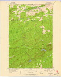
1956 · Saxon
USGS Topo · 1:24,000