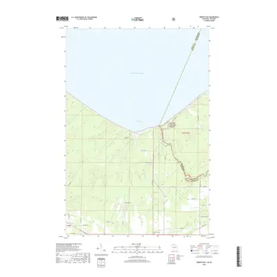
2018 Map of Oronto Bay
USGS Topo · Published 2018About this map
Saxon Harbor serves as a focal point on the southern coast of Lake Superior, where the shoreline of Oronto Bay meets a network of northern Wisconsin waterways. This 2018 survey captures the interface between Iron County, Wisconsin, and Gogebic County, Michigan, defined by the winding course of the Sturgeon R and several smaller tributaries like Graveyard Cr and Carpenter Cr. Further inland, the landscape is marked by the small settlement of Cedar and the Saxon Airport, situated amidst the wooded reaches of the Ottawa National Forest. Local history is anchored by Lake View Cem and the natural drop of Saxon Falls on the state border. The map documents a rural infrastructure of named roads, such as Co Hwy A and Kokley Rd, that connect isolated homesteads to the harbor and regional timberlands.
Find a feature on this map
45 named features on this map. Tap any name to fly to it.
Don’t see what you’re looking for? This feature index may not catch every label — zoom into the map to look around manually.
Map Details
Editions of this 2018 Oronto Bay Map
This is the sole edition of this map. No revisions or reprints were ever made.
Other maps of this area

1940 · Upson
USGS Topo · 1:48,000

1942 · Mellen
USGS Topo · 1:48,000

1943 · Little Girls Point
USGS Topo · 1:24,000

1943 · Upson
USGS Topo · 1:48,000

1943 · Little Girl Point
USGS Topo · 1:48,000

1943 · Odanah
USGS Topo · 1:48,000

1945 · Odanah
USGS Topo · 1:48,000

1945 · Mellen
USGS Topo · 1:48,000

1953 · Ashland
USGS Topo · 1:250,000
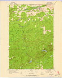
1956 · Saxon
USGS Topo · 1:24,000