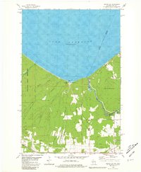
1980 Map of Oronto Bay
USGS Topo · Published 1981About this map
The Montreal River carves a winding path along the state boundary between Wisconsin and Michigan, punctuated by the dramatic drops of Superior Falls and Saxon Falls. Near the river's mouth at Lake Superior, the community at Saxon Harbor provides a hub for maritime activity on Oronto Bay. Further inland, the landscape of the Saxon township is defined by a mix of forested terrain and cleared areas, featuring family-named roads like Niemi Road and Hendrickson Rd that reflect the local heritage of the region.
Find a feature on this map
33 named features on this map. Tap any name to fly to it.
Don’t see what you’re looking for? This feature index may not catch every label — zoom into the map to look around manually.
Map Details
Editions of this 1980 Oronto Bay Map
This is the sole edition of this map. No revisions or reprints were ever made.
Other maps of this area

1940 · Upson
USGS Topo · 1:48,000

1942 · Mellen
USGS Topo · 1:48,000

1943 · Little Girls Point
USGS Topo · 1:24,000

1943 · Upson
USGS Topo · 1:48,000

1943 · Little Girl Point
USGS Topo · 1:48,000

1943 · Odanah
USGS Topo · 1:48,000

1945 · Odanah
USGS Topo · 1:48,000

1945 · Mellen
USGS Topo · 1:48,000

1953 · Ashland
USGS Topo · 1:250,000
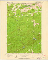
1956 · Saxon
USGS Topo · 1:24,000