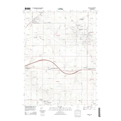
2013 Map of Orrville
USGS Topo · Published 2013About this map
The agrarian landscape of Wayne County is defined by a dense network of family farms and historical burial grounds. Orrville and Smithville anchor the region, which remains deeply connected to its heritage through sites like the Oak Grove Mennonite Cem and Old Presbyterian Cem. The geography is carved by several watercourses including Sugar Cr and Little Apple Cr, which flow past longstanding agricultural holdings like Besancon Farm and Leopold Farms. Educational and civic life is centered at the Univ of Akron Wayne Coll, while smaller clusters like Weilersville and Riceland represent the enduring rural character of the area. This 2013 survey illustrates the continued importance of the land, showing a community where modern residential developments like Little Chippewa Estates sit alongside family-named landmarks and old country crossroads.
Find a feature on this map
173 named features on this map. Tap any name to fly to it.
Don’t see what you’re looking for? This feature index may not catch every label — zoom into the map to look around manually.
Map Details
Editions of this 2013 Orrville Map
This is the sole edition of this map. No revisions or reprints were ever made.
Other maps of this area

1901 · Massillon
USGS Topo · 1:62,500

1901 · Wooster
USGS Topo · 1:62,500

1903 · Massillon
USGS Topo · 1:62,500

1903 · Wooster
USGS Topo · 1:62,500

1914 · Navarre
USGS Topo · 1:62,500

1915 · Millersburg
USGS Topo · 1:62,500

1943 · Millersburg
USGS Topo · 1:62,500

1944 · Navarre
USGS Topo · 1:62,500

1951 · Canton
USGS Topo · 1:250,000

1953 · Canton
USGS Topo · 1:250,000