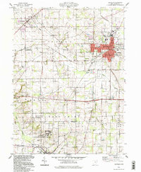
1994 Map of Orrville
USGS Topo · Published 1998About this map
The industrial and agricultural landscape of Wayne County, Ohio, is documented here in the mid-1990s, anchored by the growth of Orrville and the surrounding rural townships of Green and East Union. The map captures a transition in local infrastructure, showing the 4 Tracks rail corridor and the sprawling Apple Creek State Development Center. Educational and agricultural history is prominent, featuring the State Agricultural Experiment Station and various small schools like Maple Grove Sch.
Find a feature on this map
58 named features on this map. Tap any name to fly to it.
Don’t see what you’re looking for? This feature index may not catch every label — zoom into the map to look around manually.
Map Details
Editions of this 1994 Orrville Map
This is the sole edition of this map. No revisions or reprints were ever made.
Other maps of this area

1901 · Massillon
USGS Topo · 1:62,500

1901 · Wooster
USGS Topo · 1:62,500

1903 · Massillon
USGS Topo · 1:62,500

1903 · Wooster
USGS Topo · 1:62,500

1914 · Navarre
USGS Topo · 1:62,500

1915 · Millersburg
USGS Topo · 1:62,500

1943 · Millersburg
USGS Topo · 1:62,500

1944 · Navarre
USGS Topo · 1:62,500

1951 · Canton
USGS Topo · 1:250,000

1953 · Canton
USGS Topo · 1:250,000