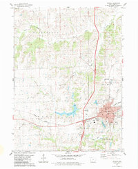
1983 Map of Osceola
USGS Topo · Published 1983About this map
Osceola serves as a central hub in Clarke County, where the intersection of interstate and rail lines defines the local geography. The city's growth is anchored by its civic core, featuring the Courthouse and several education centers like North School and East School. Outside the residential blocks, the landscape transitions into a network of water and industry, characterized by the winding path of Squaw Creek and several limestone quarries. Recreation and infrastructure are prominently featured with West Lake and the Osceola Municipal Airport providing utility to the surrounding rural townships of Washington and Fremont. Genealogists will find significant records at Maple Hill Cemetery and the more remote Cox Cemetery, while the Burlington Northern railroad lines illustrate the town's enduring connection to interstate commerce.
Find a feature on this map
37 named features on this map. Tap any name to fly to it.
Don’t see what you’re looking for? This feature index may not catch every label — zoom into the map to look around manually.
Map Details
Editions of this 1983 Osceola Map
This is the sole edition of this map. No revisions or reprints were ever made.
Other maps of this area

1950 · New Virginia
USGS Topo · 1:62,500

1951 · Osceola
USGS Topo · 1:62,500

1952 · New Virginia
USGS Topo · 1:62,500

1954 · Centerville
USGS Topo · 1:250,000

1954 · Des Moines
USGS Topo · 1:250,000

1956 · Des Moines
USGS Topo · 1:250,000

1957 · Des Moines
USGS Topo · 1:250,000

1957 · Centerville
USGS Topo · 1:250,000

1958 · Centerville
USGS Topo · 1:250,000

1965 · Weldon
USGS Topo · 1:24,000