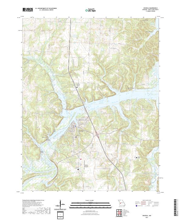
2021 Map of Osceola
USGS Topo · Published 2021About this map
Osceola sits at a strategic bend where the Osage River and Sac River converge, a landscape now dominated by the expansive Harry S Truman Reservoir. This modern survey illustrates how the rising waters of the reservoir have transformed the river valley, creating a network of inlets and islands such as Lilleys Island and Walker Island. The terrain is characterized by deep hollows like Walnut Hollow, Turkey Hollow, and Horse Hollow, which cut through the limestone bluffs including the prominent Rock of Ages Bluff. Local history is preserved in the distribution of family and community burial grounds, from the central Osceola Cem to the outlying Pleasant Mound Cem and Wisner Number 2 Cem. The map reflects the area's role as a regional hub, featuring the Osceola Municipal Airport and a dense network of state highways and country roads that navigate the complex shoreline and steep hillsides of the Missouri Ozarks.
Find a feature on this map
50 named features on this map. Tap any name to fly to it.
Don’t see what you’re looking for? This feature index may not catch every label — zoom into the map to look around manually.
Map Details
Editions of this 2021 Osceola Map
This is the sole edition of this map. No revisions or reprints were ever made.
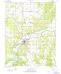
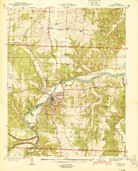
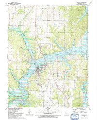
Historical Maps of Osceola Through Time
4 maps found