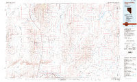
1985 Map of Osgood Mts
USGS Topo · Published 1985About this map
The Osgood Mountains and the surrounding high desert basins of Humboldt County are defined by a legacy of hard-rock mining and expansive ranching territories. This mid-1980s data highlights a concentrated industrial landscape along the eastern slopes of the range, specifically around the Getchell Mine and Riley Mine, where tailings and infrastructure sit adjacent to the remote Eden Valley. To the west, the Slumbering Hills contain the Pansy Lee Mine and Humboldt Mine, illustrating the mineral-rich character of these isolated peaks.
Find a feature on this map
93 named features on this map. Tap any name to fly to it.
Don’t see what you’re looking for? This feature index may not catch every label — zoom into the map to look around manually.
Map Details
Editions of this 1985 Osgood Mts Map
This is the sole edition of this map. No revisions or reprints were ever made.
Other maps of this area

1882 · Paradise
USGS Topo · 1:250,000

1886 · Disaster
USGS Topo · 1:250,000

1893 · Paradise
USGS Topo · 1:250,000

1893 · Disaster
USGS Topo · 1:250,000

1931 · Lovelock
USGS Topo · 1:250,000

1932 · Sonoma Range
USGS Topo · 1:250,000

1935 · Lovelock
USGS Topo · 1:250,000

1939 · Sonoma Range
USGS Topo · 1:250,000

1945 · Osgood Mountains
USGS Topo · 1:62,500

1945 · Hot Springs
USGS Topo · 1:62,500