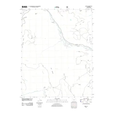
2011 Map of Osier
USGS Topo · Published 2011About this map
The Conejos River and Rio de los Pinos define the drainage of this high-elevation landscape in southern Conejos County. The settlement of Osier serves as a central point in a region characterized by remote mountain camps and scattered ranching operations. The terrain is marked by significant topographical landmarks such as McIntyre Peak, Pinorealosa Mountain, and Osier Mountain, alongside distinctive features like Spruce Hole and Alamaditas Mesa.
Find a feature on this map
27 named features on this map. Tap any name to fly to it.
Don’t see what you’re looking for? This feature index may not catch every label — zoom into the map to look around manually.
Map Details
Editions of this 2011 Osier Map
This is the sole edition of this map. No revisions or reprints were ever made.
Other maps of this area

1918 · Tusas
USGS Topo · 1:125,000

1922 · Conejos
USGS Topo · 1:125,000

1945 · Durango
USGS Topo · 1:250,000

1953 · Durango
USGS Topo · 1:250,000

1954 · Durango
USGS Topo · 1:250,000

1954 · Aztec
USGS Topo · 1:250,000

1955 · Brazos Peak
USGS Topo · 1:62,500

1958 · Aztec
USGS Topo · 1:250,000

1961 · Durango
USGS Topo · 1:250,000

1962 · Aztec
USGS Topo · 1:250,000